
(This information provided by Friends of the Beartooth All-American Road,):
The Beartooth All-American Road, also known as the Beartooth Highway, officially opened on June 14, 1936. First referred to as “the most beautiful drive in America”, by Charles Kuralt, On the Road television correspondent, the Highway is a destination in its own right. It is the highest elevation paved highway in the Northern Rocky Mountains open to travelers seasonally from May to October.
The Beartooth Highway is a 68-mile travel corridor, beginning (at its eastern most terminus), just south of Red Lodge, Montana at an elevation of 6400 feet and ending (at its western most terminus) near the Northeast Entrance to Yellowstone National Park and Cooke City and Silver Gate, Montana, at an elevation of 7500 feet. In between those two elevations, the road rises to 10,947 feet at Beartooth Pass in Wyoming. The section of the Beartooth Highway that has been awarded the National Scenic Byways “All-American Road” status is a 54 mile section of the Highway beginning 8 miles south and east of Red Lodge and ending just east of Cooke City, Montana.

The following pictures were taken from Cody, Wyoming to Red Lodge, Wyoming. The Beartooth Highway starts at Red Lodge.


Looking down at the City of Red Lodge, Montana

Mural on the wall of a building in Red Lodge

Pictures taken Red Lodge


We ate lunch at the Red Lodge Cafe


Murals inside the cafe
Now we are traveling the Beartooth Highway
Now we are traveling the Beartooth Highway
The skies were blue sometimes today but a lot of the time they were kind of grey so not the best lighting for pictures. Believe me, it was a beautiful drive!


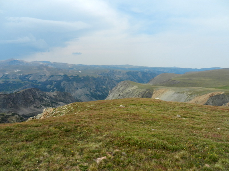
Rock Creek Vista Point Rest Area & Interpretive Trail – Elev 9190′. This wayside is twenty-one miles from Red Lodge. Vista Point provides breathtaking views of Rock Creek Canyon and Hell roaring Plateau.
At the Rest Area there was all kinds of action with these little chipmunks. It was too funny watching everyone feed these little guys who are apparently well fed as you will be able to see in these pictures.

These critters are The Least Chipmunk (stripes around eyes)


Now on to Scenery


These guys are not going to starve around here!


End of Rock Creek Vista and Back on the Road


I saw something move out of the side of my eye so Lee pulled over and we starred at this rock. This guy kept coming up one side of the rock and then the other but he wouldn't come out all the way. He finally got tired of us starring at him and moved so we could get a picture of all of him. It was hard to identify him until we got the tail in the picture!

Yellow-bellied Marmot


I was in the truck looking at a scene similar to that above except it had larger rocks. I saw something white show above the ledge and move across it. I told Lee it had to be a Mountain Goat but they were too well hidden from this side. Lee decided to see if we could go farther up the road as it turned and see if we could see what was behind the ledge. We had to risk life and limb walking down the road, then behind the guard rail and finally we found them. It was a herd of mountain goats!

Mountain Goats


While we were watching these goats and taking pictures, the wind came up and blew Lee's hat right off his head and down the mountain. There was no way we could go get it! He said, "Well, I bought this one in Jackson, Wyoming and this one was about shot." We will eventually get to Jackson!


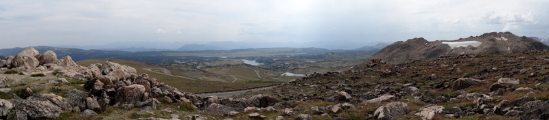
West Summit, Beartooth Pass Overlook – Elev 10,947′. This is the highest point along the Highway with spectacular views in every direction. In late may and early June, this high elevation are can produce harsh weather conditions including blowing snow and fog, resulting in short term (less that 24 hours) highway closures.


Lots of Mountain Wild Flowers!


Top of the World Store – Elev 9,400′. This stop offers food, fuel, gifts and lodging and is 38 miles from Red Lodge and 25 miles from Cooke City. The store was originally built on Beartooth Lake in 1934 then moved to its current location in the 1960’s It is operated under a special use permit from the Shoshone National Forest.

Top of the World Store


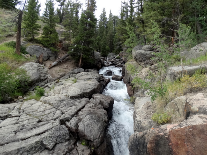
Beartooth Bridge, Falls and Ravine – Elev 8,900′. Beartooth Lake outlet flows under an historic bridge constructed in the 1930’s using unique construction techniques. The high mountain water rushes south through the ravine and then turns to present a magnificent waterfall to travelers along the highway. A quick side trip to the Beartooth Recreation Picnic Area takes you to Beartooth Lake, which is great for fishing and canoeing against the backdrop of Beartooth Butte.


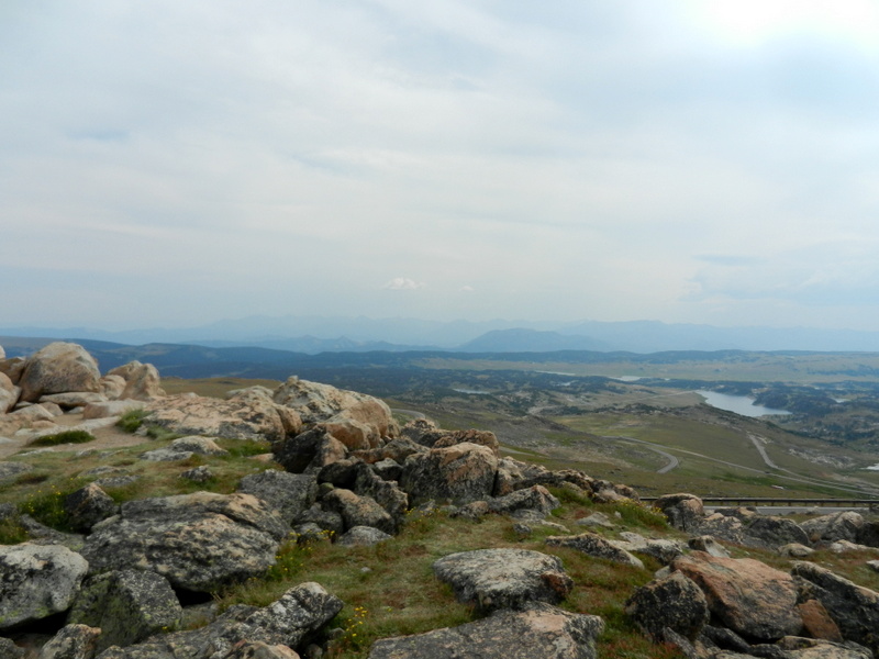
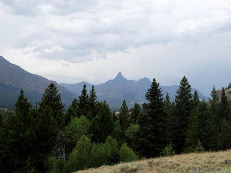
Pilot and Index Peak Overlook – Elev 8718′. These two peaks located many miles west of the pullout in Wyoming rank in the top ten of the most often photographed scenes along the Beartooth All-American Road. In addition o the Peaks, this location looks down on the beautiful Clark’s Fork River Valley, and the Wild and Scenic Clark’s Fork River that ultimately flows into the Yellowstone River.


No comments:
Post a Comment