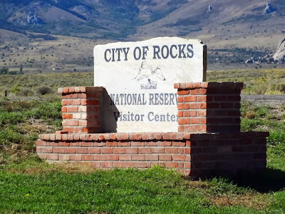
We learned a lesson today, however. We learned that GPS units are not to be trusted blindly. Lee got instructions how to get from our campground to the City of Rocks National Reserve near Almo, ID from Microsoft Streets and Trips. The route the software mapped looked okay and we began following it. Unfortunately, the route very quickly deteriorated into poor quality gravel roads that seemed to not be leading where we wanted to go. We drove about 15 miles on dusty, rough gravel roads at about 15 mph before deciding to go back to the last paved road and head for Oakley as we read there was a way to the Reserve from there. We found the paved road and turned east for probably 10 miles to get to Highway 27 then south to Oakley. We began the trip out of Oakley on what looked like a pretty good paved road. However, after about a mile the road reverted to more rough gravel. We then turned to our GPS which directed us along the route we were on. After 10 miles, the GPS instructed us to take a sharp left but there was no road just a wide spot in the road. We decided to use that wide spot to turn around and go back toward Burley to get to Hwy 77 which we were sure would be paved. Sure enough after about four hours, we arrived at the Visitor Center for the Reserve in Almo. The trip should have taken about 1 1/2 to 2 hours to go the 85 miles.
We were so thankful to have finally arrived but we couldn't help complaining to one of the Rangers in the Visitor Center about how we got here. She confirmed that we should not have used a GPS to get to the Reserve as it would likely bring you in on the road from Oakley. She said this road is maintained once a year in the spring and the rest of the year, horse trailers and heavy trucks beat the road to death but it doesn’t get maintained. She said she wouldn’t travel that road on a bet. We won’t make this mistake again.
 |
| Visitor Center |
 |
| Replica Covered Wagons |
After our lunch, we both were revived and we set off to see what we could see. There are 14,407 acres of land in the City of Rocks and 12 miles of road. A lot of the area though is behind fence so there is no danger of walking 14,000 acres worth. However, you can walk around the boulders where the campgrounds are and you can sleep in a boulder if you desire as there are several campgrounds among the boulders! It is also a popular place to climb and there were lots of climbers out today.
 |
| Rock Creek Rock House |
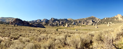
The City of Rocks is an impressive site. There are granite formations rising out of the sagebrush that form the City of Rocks. Some of these unique formations are over two billion years old and tower as high as 600 feet.
 |
| Treasure Rock |
Tales of a stage robbery complete with lost loot buried beneath one of the City’s rocky crags (Treasure Rock) have formed part of local lore for almost 120 years. Most agree that the Kelton stage was robbed circa 1878 of $90,000 - $200,000 in gold bullion.
 |
| Mary by Treasure Rock |
 |
| There are large formations and small ones |
 |
| Lee by Treasure Rock |
- Sallie Hester - August 3, 1849
"Another 2 miles enter a rocky dell some 4 miles long by a winding road running among the most grotesque rocks standing out singly in the valley, or grouped fantastically together. There were sphynxes and statues of every size, and haystacks and wigwams and castles, and towers, and pyramids and cones and projecting turrets and canopies, and leaning columns, and so on throughout a thousand varieties of fantastic shapes."
- Bernard J. Reid - August 11, 1849
"Last eve went to the City rocks. They are at the junction of the California and Salt Lake roads. They are white and about 300 ft high running up to a peak. They are composed of a substance resembling salts and are in a state of decomposition. A few more years and then will be leveled with the ground. They look at a distance like a ruined city."
There is a large boulder called "Camp Rock" that has some writings from some of these immigrants.
 |
| Camp Rock |
 |
| Immigrant Signatures |
We were kind of like the immigrants in that as we drove around we kept telling each other what the next large outcropping looked like.
 |
| Looks like a face laying down |
 |
| Elephant Rock |
 |
| Window |
 |
| Lee looking through the window |
 |
| Can you find the climber |
 |
| Panorama |
 |
| A rock climber |
 |
| Can you see the rock climber? |
 |
| This one is really interesting |
 |
| A Balancing Rock |
 |
| Look at how this is formed |
 |
| They are hanging on somehow |
 |
| What do you think this looks like? |


No comments:
Post a Comment